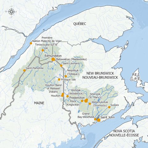
The Wolastoq (Saint John River) originates in the Maine and Quebec. It flows for 673 km. The resulting watershed covers 55,000 km. It is the largest watershed east of the Mississippi and St. Lawrence rivers.
The river enters the Province of New Brunswick at Edmundston. It winds its way through the western part of the province, before emptying into the Bay of Fundy at Saint John.
It is listed as one of the major rivers in Canada. The river played a prominent role in settlement patterns, military actions and the movement of people, goods and ideas over time. It was designated as a Canadian Heritage River in 2013.
WolastoqThe river was originally named “Wolastoq” or “the beautiful and bountiful” river by the Wolastoqiyik – “People of the beautiful and bountiful river.” |
History
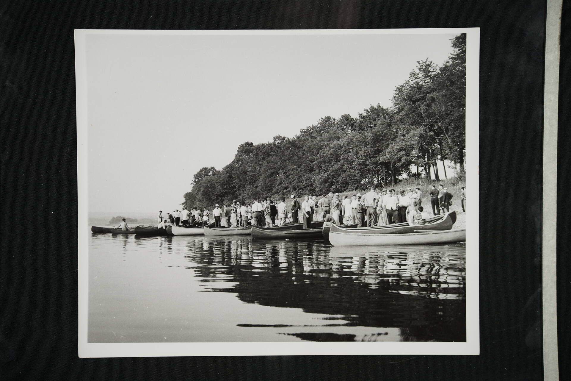
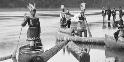
The area along the river was first settled by the Wolastoqiyik People more than 10,000 years ago. They called the river the Wolastoq and used it for travel, and to access food and other resources. Portage routes to other watersheds were vital for trade and communication.
The river ran the length of their territory. It has nurtured the Wolastoqiyik People physically, culturally and spiritually over millennia.
Tradition tells us that the watershed was created by a great man who saved the people and brought water to them by felling a tree on the monster Aglebe’m. The Gluskup stories record the creation of many of the river’s features, including the story of Gluskup and the Giant Beaver. A painting depicting this story, by Percy Sacobie, hangs in the departure lounge of the Fredericton International Airport.

Over the years, the Wolastoqiyik People continued to live along the river and its tributaries. European settlers arrived over 400 hundred years ago. Samuel de Champlain landed at the mouth of the river on June 24, 1604 – the feast day of St. John the Baptist. He named the river the Saint John.
The river played an important role in the settlement of the French and later the British. Called “the road to Canada,” the Wolastoq (Saint John River) was the key transportation route between Upper and Lower Canada.
The first European settlement along the river occurred in 1631. This is when Charles de la Tour constructed Fort La Tour at the site of present-day Saint John. Additional settlement occurred upriver over time.
Fredericton
The area now know as Fredericton was first settled by the Wolastoqiyik People. Their ancestors remain in the area. The French built a fort at the mouth of the Nashwaak River between 1691 and 1692.
Called Fort St. Joseph, it was more commonly known as Fort Nashwaak. An attack by soldiers from New England was deflected in 1696. Fort Nashwaak was dismantled in 1700.
Acadians remained at Pointe Sainte-Anne on the opposite side of the river, near present day Government House. This ended with the St. John River Campaign in 1759, when the area came under British control.
In 1783, the United Empire Loyalists arrived in New Brunswick, after fleeing the American Revolution. They settled in Saint John and arrived at Pointe Sainte-Anne the same year.
In 1784, New Brunswick became a province separate from Nova Scotia. In 1785, Fredericton received its name and was made Capital of New Brunswick.
During the 18th and 19th Centuries, fur trade, logging, agriculture and ship building were the major industries along the river. It continued to be the highway that transported people and supplies.
Today, the watershed supports critical economic sectors including hydroelectricity, agriculture, forestry, pulp and paper production, food manufacturing, and tourism.
The power of the river is never more obvious than in the spring of the year, when thaw conditions can result in massive flooding. Up and down the river valley, residents join in with the provincial and local governments’ River Watch efforts.
Running the River
***See Points of Interest Below
Running the Wolastoq (Saint John River) through the Fredericton Capital Region takes paddlers past a variety of landmarks and attractions. Starting at Meductic, head down river to Nackawic and their marina and giant axe. Destination Nackawic has you covered for activities.
Continuing along the river, paddlers will find Kings Landing Historical Settlement. Step back in time 200 years at this living history museum. Officially, paddlers and boaters are now on the Mactaquac Head Pond. Formed by the creation of the Mactaquac Generating Station, stop and explore the Mactaquac Provincial Park.
Below the dam, you will find the Bilijk (Kingsclear First Nations) community and then the Mactaquac Biodiversity Facility/Kingsclear Fish Hatchery. Learn how fish get up over the dam.
Next on the journey, paddlers will see where the Keswick River empties into the Wolastoq (Saint John River). Continuing down river, there is a series of islands known as the Keswick Islands. One of the largest is Sugar Island. It continues to be used for agricultural purposes.
Next is Eqpahak Island. The Wolastoqey word “eqpahak” means “place where the tide stops coming in.” This place has been an important geographic location to Indigenous people for more than 3,000 years.
Other islands include Hartt Island. Enjoy the nearby campground, water park, playground, miniature golf, and boat launch. Closer to downtown Fredericton, you will find Ross Island. Owned by the City, the island will be used for recreation.
Coming into Fredericton, paddlers will pass Government House. A place where Indigenous, French and British history mingles, travellers will find the St. John River | Wolastoq Canadian Heritage River Plaque. Next door, find the Fredericton River Centre, formerly the Small Craft Aquatic Centre.
Arriving in the centre of the city, visit the Historic Garrison District, including Officers’ Square, Barracks Square, and the New Brunswick’s 104th Regiment of Foot Bridge. Year-round activities keep residents and visitors busy.
Visit the NB Sports Hall of Fame and Fredericton Region Museum to learn more about the region and province. Across from Officers’ Square is the Regent Street Wharf and just down the street is the Beaverbrook Art Gallery, offering an incomparable collection of historical and contemporary paintings, sculpture and more.
Across the river, find the mouth of the Nashwaak River another great paddling destination, with lots of beauty and history to explore. Visitors will also find the urban community of Sitansisk/St. Mary’s First Nation.
Leaving the city, travellers will pass the Fredericton Yacht Club, before passing old wharves and fertile agricultural land filled with roadside farmer stands. Next comes the Town of Oromocto. This is where the Oromocto River joins the Wolastoq (Saint John River).
Visit all that Oromocto has to offer including the Oromocto Marina, and the nearby Oromocto and Thatch islands, as well as other attractions and businesses. The Oromocto River Watershed offers paddlers another great river to explore.
Oromocto is home to Base Gagetown (5th Canadian Division Support Base – Gagetown. Leaving the town, paddlers will glide past the Welamukotuk (Oromocto First Nations) community.
Continuing down river, the beauty of the Wolastoq (Saint John River) is on full display, as paddlers slide past agricultural land, small communities and a variety of islands. Middle Island is a popular destination for boaters.
The next major community is the Village of Gagetown, one of the original settlements along the river. Now part of the regional community of Arcadia, the area is a popular boaters’ destination.
Watch for the river ferries as you glide past the communities of Gagetown, Cambridge-Narrows, Hampstead, and Waterborough, before continuing downriver to Evandale and the end of the Fredericton Capital Region.
Log Boom FoundationsNear Ross Island, and in other places along the Nashwaak River and Wolastoq (Saint John River), travellers will see what looks like a series of small islands connecting the island to the main shore. These are log boom foundations. They were commonly constructed of piles or large stones placed into cribs in a river to form small islands. The booms were themselves large groups of floating logs linked together end to end, like a floating chain. Connecting the booms to the foundations allowed for the logs to be strategically guiding along their path. Image 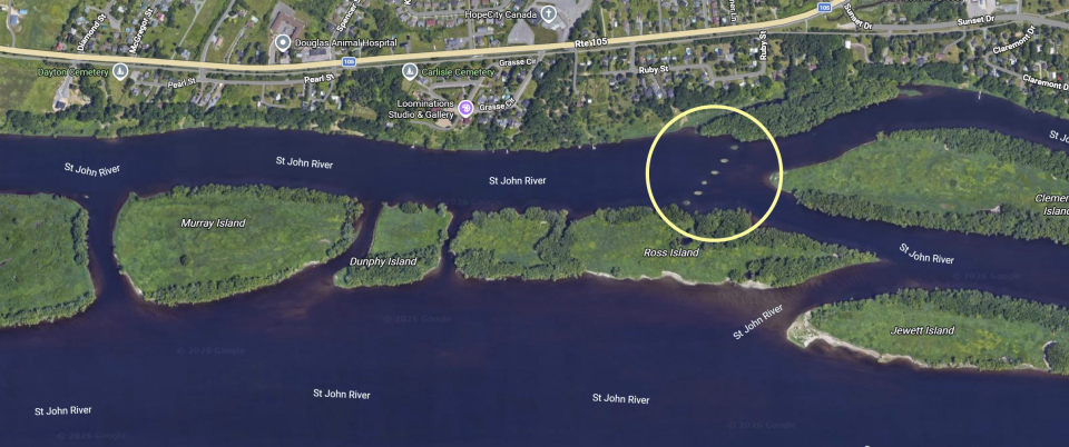 |
Resources
- St. John River Society
- Nashwaak Watershed Association
- Oromocto River Watershed
- Fredericton Capital Region Tourism
- City of Fredericton
- Town of Oromocto
- Arcadia
- Bilijk (Kingsclear First Nations)
- Sitansisk (St. Mary’s First Nation)
- Welamukotuk (Oromocto First Nations)
Points of Interest
- Destination Nackawic
- Kings Landing Historical Settlement
- Mactaquac Provincial Park
- Mactaquac Dam / Generating Station
- Mactaquac Biodiversity Facility (Kingsclear Fish Hatchery)
- Bilijk (Kingsclear First Nations)
- Keswick River
- Keswick Islands:
- Sugar Island
- Eqpahak Island: The Wolastoqey word 'eqpahak' means 'place where the tide stops coming in’. This place has been an important geographic feature to Indigenous people for more than 3,000 years.
- Hartt Island
- Ross Island: Owned by the City. Will be opened for recreation.
- Government House:
- Government House looks out over spiritually significant Indigenous site; add name
- St. John River | Wolastoq Canadian Heritage River Plaque
- Fredericton River Centre, formerly the Small Craft Aquatic Centre
- Historic Garrison District, including Officers’ Square, Barracks Square, and the New Brunswick’s 104th Regiment of Foot Bridge
- Fredericton Region Museum
- Regent Street Wharf
- Beaverbrook Art Gallery
- Sitansisk (St. Mary’s First Nation)
- Nashwaak River
- Fredericton Yacht Club
- Welamukotuk (Oromocto First Nations)