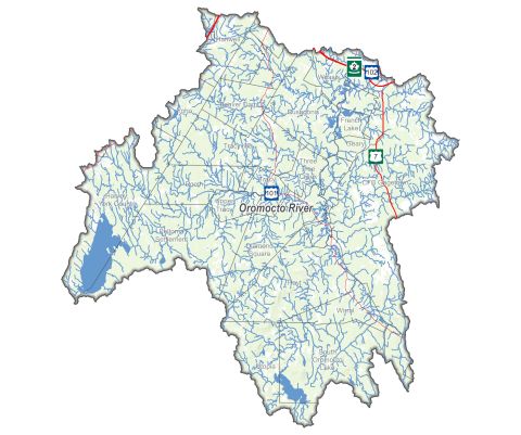
The Oromocto River watershed drains an area of approximately 2,500 km in southwestern New Brunswick. It is almost half the size of Prince Edward Island. The watershed occupies space in four provincial counties: Sunbury, York, Charlotte, and Queens.
The watershed starts in two different lakes – the North Oromocto Lake, near Harvey, NB and the South Oromocto Lake, near Wirral, NB. The North Branch Oromocto River flows for 45 km. The South Branch Oromocto River flows for 39 km. Both end near Fredericton Junction, NB.
Here they come together to form the Oromocto River, which flows for another 42 km draining into the Wolastoq (Saint John River) at Oromocto, NB. The river becomes tidal at low water. This results in a calm, flat basin of water containing various streams, lakes, and ponds.
OromoctoThe word Oromocto comes from the Wolastoqey word welamukotuk (WEL—A—MOOK—TOOK), which means "deep water" or "good river for navigation by canoe". It reflects the fact that even at low water the tidal portion of the river averages four metres (13.1 feet) in depth. |
History
First settled over 10,000 years ago, the watershed is the traditional territory of the Wolastoqiyik People. They used the river for travel, and to access food and other resources.
Portage routes to other watersheds were vital for trade and communication. One of the most significant was an ancient trail that joined the Wolastoq (Saint John River) at Oromocto to Passamaquoddy Bay along the Bay of Fundy.
While the Wolastoqiyik People continued to live along the river and its tributaries, the French arrived in the area prior to 1758. Many fled during the expulsion of the Acadians, while several continued to live inland. The United Empire Loyalists arrived in 1783, following the American Revolution. They settled along the Wolastoq (Saint John River) and its tributaries.
For the first inhabitants, the forest provided cedar and birch bark for canoes. Full scale harvesting of timber in the watershed began around 1800. The timber and lumber trade dominated the area for more than 50 years (1825-1875). More than 50 large wooden ships were built in Oromocto.
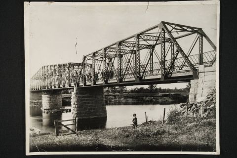
Large logs used for ship masts were harvested inland and brought to Oromocto by river. To this day, travellers will find Mast Road in the Tracy area heading towards Fredericton Junction. This was the route used to transport these large logs to the Oromocto River back in the heyday of ship building.
Today
The forest industry remains as an economic mainstay in the watershed. Commercial fishing of gaspereau and eel continues. Agriculture remains a minor part of the economy.
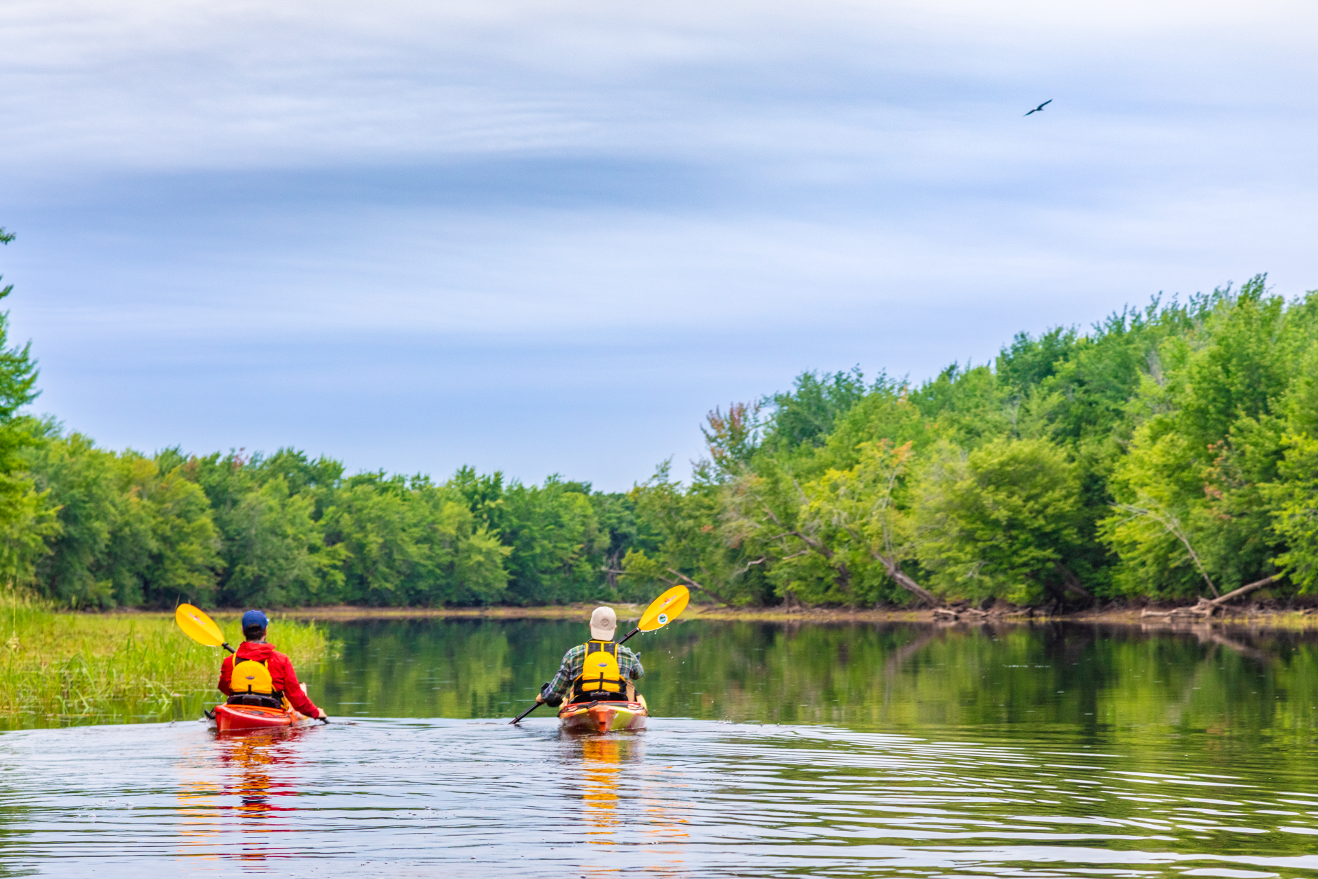
The watershed offers several adventure trails and covered bridges to explore. Outfitters and private citizens continue to enjoy hunting, fishing, and outdoor recreation. A paddle down the Oromocto River takes you through wetlands and wilderness areas that are some of the more significant and beautiful in the province.
The Town of Oromocto offers a variety of activities for residents and visitors alike, including parks, museums, shopping, and restaurants. Sir Douglas Hazen Park is located at the mouth of the Oromocto River and is home to the Oromocto Marina.
Across from the park, paddlers will find Thatch Island and Oromocto Island. Only accessible by boat, they are popular paddling and hiking destinations. Nearby, visitors will find old wharves maintained by the St. John River Society, as well as local farm stands. Oromocto is to the Base Gagetown.
Running the River
***See Points of Interest below.
Running the Oromocto River takes paddlers and boaters through some of the richest wetlands in the province. See landmarks and learn more about the attractions of the lower watershed.
At Fredericton Junction, the South Branch and North Branch of the Oromocto River come together as one to form the Oromocto River.
Plagues and a block house recall an ancient portage route used by the Wolastoqiyik People, as well as the area’s British History.
At Pride’s Landing, imagine the scene as giant trees to be use as ship masts were put into the water. Further inland, Mast Road reminds travellers of this proud past.
Travelling down river, enjoy the beauty of trees and grasses along the river. Arriving at French Lake, learn more about the history of the region at Hanson’s Art Gallery and Sculpture Garden.
It was in this area that the Battle of French Lake was fought on September 8, 1759, as part of the St. John River Campaign. Here, the Acadian militia ambushed British rangers.
Continuing along, paddlers will come to the Sunbury-Oromocto Park and Campground and then pass the point where the Rusagonis Stream connects to the Oromocto River.
From here, wind you way into the Town of Oromocto and its many attractions. The Oromocto River flows into the Wolasoq (Saint John River) at this location, near the Oromocto Boat Club.
Base Gagetown
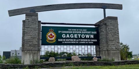
Oromocto is home to Base Gagetown (5th Canadian Division Support Base – Gagetown).
The Base officially opened in 1958 as a training facility. It includes a 1,100 km training area, 1,500 km of roads, 900 km of tracks, and 740 buildings. It is the second largest military base in Canada and the largest in Eastern Canada.
Base Gagetown is the second largest public sector employer in the province. Base employees and their families represent approximately 75 per cent of the residents of Oromocto. The total number of personnel on the Base increases dramatically during the year based on training efforts.
The Base consists of a support group and a training centre. There are also six operational units and various other units providing services to the soldiers. The Base maintains a strong relationship with its surrounding communities and is appreciative of the tremendous support it receives from them.
Resources
- Oromocto Watershed Association
- Town of Oromocto
- Base Gagetown
- Fredericton Capital Region Tourism
- St. John River Society
- Welamukotuk (Oromocto First Nations)
Points of Interest